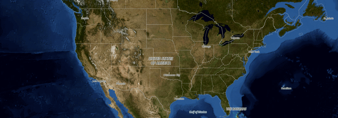
Satellite and Aerial Imagery
After you have Setup an Interactive Map, you can now add a satellite and aerial view for better context.
Subscription
Aerial imagery is part of our Everything API, which is only available under our Pro Plan subscription.
You must have the Everything Api service enabled on your api key's settings page.
*Pro Subscription Required
Pricing
Aerial imagery is 1 Credit per Aerial Map Tile, in addition to any underlying Vector or Raster Map Tiles loaded beneath the Aerial layer.
Coverage
Satellite imagery is available worldwide, but Aerial imagery is only available in the United States. Using Slpy JS will automatically hide the option when the map view is on an unsupported area.
| zoom | Description |
|---|---|
| 0-7 | Worldwide - Satellite |
| 0-16 | United States - Aerial imagery |
Enabling
Slpy JS
For those configuring maps with Slpy JS, adding the function line below will automatically configure styles and an icon will appear and disappear if coverage is available.
		//settings
		//initialize map code
		//after map code

	    addAerialImagery(map);
Custom Setup
For custom software setups, you can find out endpoint urls below for the PNG Raster Tiles. You can layer vector tiles over the unlabeled map to get a hybrid map.
| Item | Description |
|---|---|
| Unlabeled | https://api.slpy.com/v1/app/aerial-imagery/{z}/{x}/{y}.png?key={your_api_key} |
| Labeled (English Only) | https://api.slpy.com/v1/app/aerial-topo/{z}/{x}/{y}.png?key={your_api_key} |
| Example | https://api.slpy.com/v1/app/aerial-topo/4/5/6.png?key=abc123 |
Next Steps
Customize and add features to your new map
Settings & Features
- Common settings and Language Support.
- Content Filtering
- Satellite, Street Level, and other features.
- Compatibility for older browsers.
Markers & Popups
- Add markers to your points
- Include popups on your page for more info.
- Highlight points on your map.
- Helper functions
Map Design
- Customize your maps look
- Night Mode, Greyscale.
- Get the Slpy Style source code.
Search & Geocoding
- Add a search bar to your map.
- Translate addresses to coordinates
- Search for points of interest.